Day 29 (7/12) - Packwood, Mount Rainier National Park, Drive to Newberg, Newberg
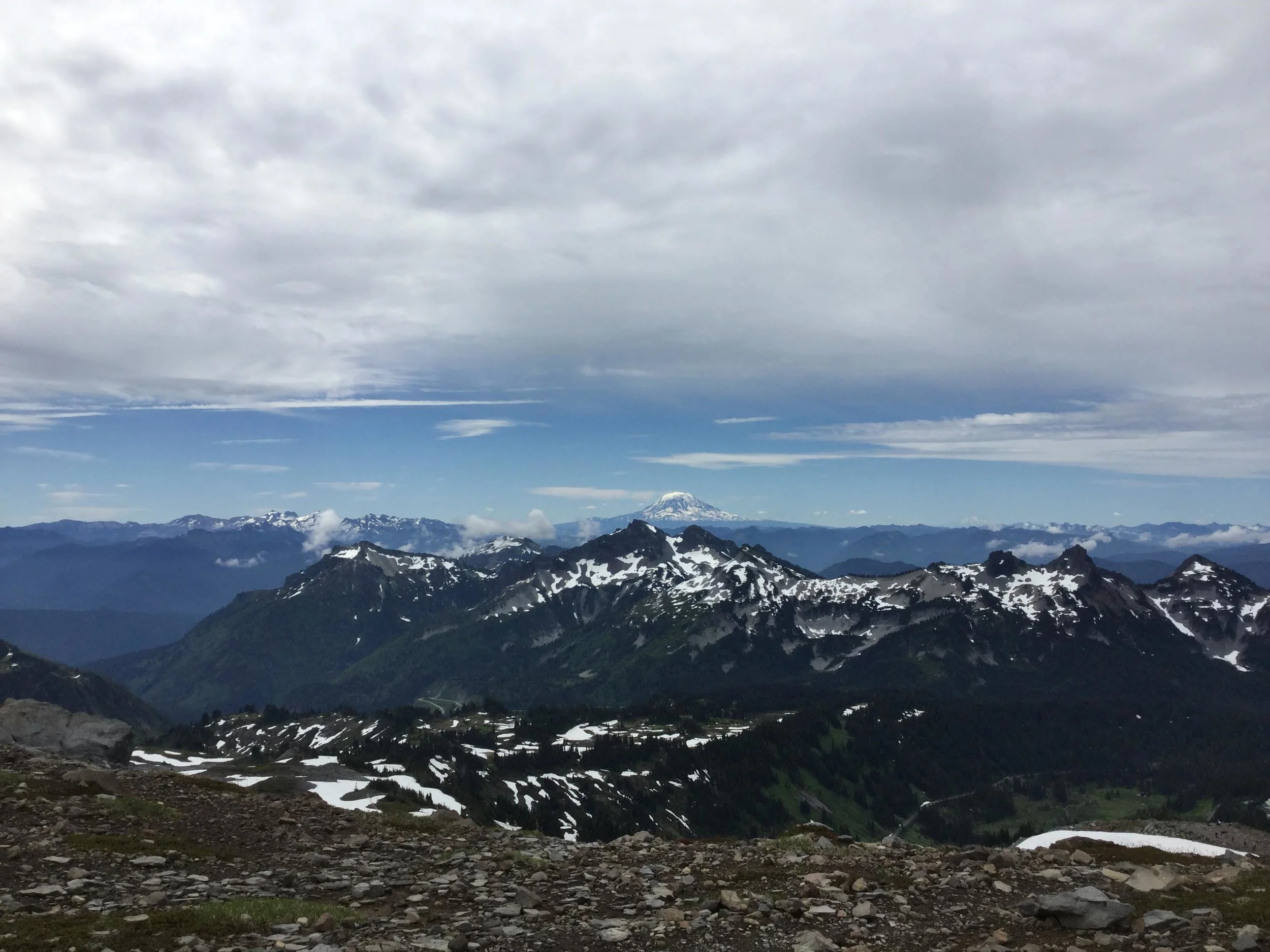
This morning we woke up at 7:30 to eat breakfast and pack before driving to Mount Rainier National Park. A lot of people think Mount Rainier is a normal 14,411 foot tall mountain. It’s not. It’s an active volcano that erupted last in 1894 and could erupt any day. If so, it could cause lahars that reach the Puget Sound, and flooding and post-lahar sedimentation zones just west of Seattle, 64 miles away. “A lahar is a violent type of mudflow or debris flow composed of a slurry of pyroclastic material, rocky debris and water. The material flows down from a volcano, typically along a river valley.” -Wikipedia. We did a hike on it that was 5.4 miles, and started almost straight up, along with various snow fields we had to cross. It was hard, but the views were amazing. From the tallest point, you could see Mt. Adams and Mt. St. Helens to the south in Washington, and Mt. Hood farther south, 88 miles west of Portland, Oregon. Going down was a lot faster than going up. For lunch we stopped at a diner in Elbe, Washington on the way to Newberg, Oregon. We arrived around 6:00. After snacking for dinner, we went to bed again.
Don’t forget to like and comment below!
To Rahul Thapar: I’ll stop “pandering for comments” if you leave me a few yourself.


Left to Right: Buck of the side of the path, view of mountains, Mt. Rainier, view of mountains with labels